Piedmont Plateau | Coosa | Best Seasons: Fall | Spring
At 1,152′ Flagg Mountain is one of the southernmost mountains along the eastern seaboard above 1,000′. It’s the symbolic southern terminus of the Appalachian Mountain Trail, stretching north to Cap Gaspe’, Quebec, Canada, and even further north across the St. Lawrence Seaway to Newfoundland’s Appalachian Mountains and an additional 500 miles of trail! For hikers going north from Key West, FL, on the Eastern Continental Trail or from the Alabama/Florida state line to New York state on the Great Eastern Trail, Flagg Mtn. is the first mountain they’ll come to. Or if walking south it’s the last mountain they’ll cross. Summer Tanagers nest here as do Pine Warblers. Anything is possible in spring or fall–winter is probably the least productive season for the mountain, but Pine Warblers, Eastern Phoebes and raptors are here year-round, along with flocks of Wild Turkey.
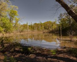
The location within the Weogufka State Forest provides an excellent location for raptor watching, particularly during spring and fall. The dense mixed forest provides good habitat as a stopover point for spring and fall migrants. Expect to see typical woodland birds, plus the possibility of almost any raptor found in Alabama.
Listed on the National Historic Tower Site as tower #250, Flagg Mountain Lookout Tower is located in the Weogufka State Forest in Coosa County, Alabama. Built by the Civilian Conservation Corps (CCC) in 1935, the 50 foot stone tower is a unique structure. The walls are 2 to 3 feet thick. Large timbers were laid in the rock in a criss-cross pattern and have been replaced with inlaid stone. Additionally, ten cabins were built on the mountain by CCC crew.
The 12’x 12’ cab lookout was staffed by the Alabama Forestry Commission until 1989. Work is currently underway to restore the tower and surrounding cabins to their glory. Currently, they are not accessible to the public, but the view from the top of Flagg Mountain is 360 degrees.
Note: this is a remote location located at the top of a steep, rocky dirt road. Although most vehicles can safely traverse the last 1/2 mile drive, it is very rocky and steep. High clearance vehicles are recommended. Walking the last 1/2 mile is also an option.
Site Accessibility
There is a 1/2 mile fully accessible ADA compliant trail that leads from a gravel parking lot to the top of the mountain and the observation tower. The trail itself is a 60 inch wide poured cement trail with a gentle slope and many, many switchbacks to get you to the top of the mountain, leading through the forest. The parking lot is gravel, but has designated handicap parking. The road that leads to the trail is passable, but very bumpy and not suitable for very low clearance vehicles.
from I 65 South from Birmingham: Take exit 212 for AL-145 toward Clanton/Lay Dam 0.4 mi. Turn left onto AL-145 N 1.8 mi. Turn right onto Co Rd 55 4.1 mi. Turn right to stay on Co Rd 55 14.5 mi. Turn right 0.4 mi. Continue onto CC Camp Rd 1.8 miTurn left. Destination will be on the left 0.2 mi
Amenities Available: Camping (tent/RV), Gravel or Dirt Trails, Lodging (hotel/cabins), Paved Trails, Picnic Tables, Wheelchair Accessible
Nearby Sites
Chapman’s Creek
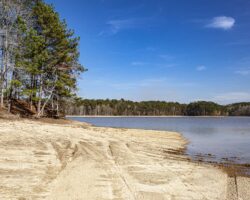
Chapmans Creek is a quiet, remote public use area on scenic Lake Martin offering primitive camping, a picnic area, and a boat ramp. This is a serene birding stop characterized by mature mid- and upper-story habitat with a well-developed shrub layer, …
Coosa WMA Double Bridges
The Coosa WMA (Wildlife Management Area) offers outstanding birding opportunities. The Double Bridges location is on Hatchet Creek at Lake Mitchell, and offers access to a trail that is currently approx. 11.0 miles long for a 22.0 mile hike in and o …