
Coastal, Fort Morgan Loop | Baldwin | Best Seasons: Fall | Spring | Winter
Fort Morgan is a classic migrant trap, and a birding paradise when adverse weather during spring migration may cause spectacular “fallouts” of colorful migrants. Many vagrant species find their way to this favorite birding spot, which can equal Dauphin Island in excitement. In fall, hundreds of migrating hawks can be seen moving west over the Fort. Winter produces many waterbirds and sparrows. Summer is the slowest season, but can be good for terns. There are restrooms at the ferry landing and at the museum, plus a snack bar at the ferry landing. Bird checklists are available at the museum.
GPS: N30.22951 W-88.00827
Fort Morgan Stables
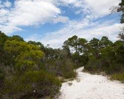
Just after the entrance kiosk at the eastern sea wall, park and bird the wooded area on the right known as the Stables [0.2]. This is the best spot in the park for passerine migrants, and should be explored thoroughly. The Hummer/Bird Study Group maintains their banding station in the Stables area each April and October and welcomes visitors.
GPS: N30.23018 W-88.01197
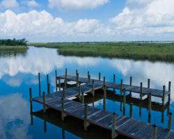
Fort Morgan Ferry Landing
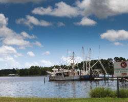
From the Stables, continue west to the ferry landing parking lot [0.1], where an admission fee is paid to enter the park. The ferry to Dauphin Island runs every hour and a half starting at 8:45 a.m. Check the adjacent lawn and Live Oaks just west of the parking lot for migrants. Gulls, terns and wading birds populate the riprap along the edge of the shoreline, along with several species of shorebirds.
GPS: N30.23164 W-88.01497
Fort Morgan Middle Ground
The brush and scrub opposite the landing are known as the Middle Ground, another good migrant spot. Fields and lawns to the west, between the ferry landing and the museum, are excellent for open-country birds.
GPS: N30.23082 W-88.01485
Fort Morgan The Fort
From the ferry landing parking lot, continue west to the Fort parking lot [0.5]. Check the thick vegetation around the Fort for a variety of migrants.
Completed in 1834, Fort Morgan was active during four wars the Civil War, the Spanish-American War, and World Wars I and II. The fort is most famous for its role in the Civil War Battle of Mobile Bay. Union Admiral David Farragut damned the torpedoes and went full speed ahead to win the battle. The massive fort contains more than 40 million bricks and pays tribute to the skilled masons, many of whom were enslaved African Americans.
GPS: N30.22916 W-88.02168
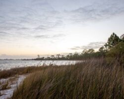
Fort Morgan Marsh
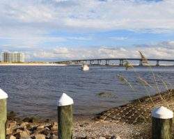
The marsh and field area south of the Fort can be observed from the sea wall on the south side. Please take care around the homes here. The marsh can produce a variety of species, from wading birds, wintering Wrens and the occasional rarity. Walk to Mobile Point to the south, either along the beach or between the dunes and the marsh. This is a good seawatching spot, and the point itself is excellent for gulls and terns.
GPS: N30.22712 W-88.02380
Site Accessibility
Restrooms at the ferry landing are accessible but must be accessed through a grass field. Restrooms inside the fort are accessible by sidewalk. The site is not fully accessible, but there are multiple areas that are very accessible. And the ferry ride from Fort Morgan to Dauphin Island is an experience everyone can enjoy as well.
If following directions provided in the Coastal Birding Trail booklet, Fort Morgan is located at the western extremity of the peninsula and is an important stopover for spring and fall neotropical migrants.
Amenities Available: Gravel or Dirt Trails, Paved Trails, Picnic Tables, Restrooms
Nearby Sites
5 Rivers Delta Resource Center
5 Rivers sits on the banks of one of the canals that traverse the Mobile-Tensaw delta. The decks of the Delta Hall and the perimeter trail around the facility provide excellent vantage points to observe birds of the surrounding marsh and waterways. I …
Boggy Point
Boggy Point Boat Launch, an Alabama Department of Conservation and Natural Resources facility, offers a small beach with an excellent view of Robinson Island, a roosting site for herons and egrets, to the east. Robinson Island offers important habita …
Bon Secour National Wildlife Refuge – Jeff Friend Trail
The Jeff Friend Trail is a one-mile loop to Little Lagoon. Habitats include maritime forest, freshwater marsh and open water along the north shore of Little Lagoon. A variety of species are possible-waterbirds, raptors, songbirds and other passerines …
Bon Secour NWR – Mobile Street
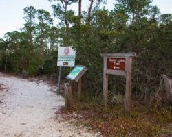
Mobile Street is a paved road leading to the beach, with a parking area for the one-mile (each way) Gator Lake Trail, which connects Mobile Street with the Pine Beach Trail. This narrow trail can be good for winter birding where you may see Blue-gray …
Bon Secour NWR – Pine Beach Trail
At the Pine Beach trailhead stands an interpretive kiosk with trail maps and bird lists. This is a two-mile trail (each way) southeastward to the beach by way of Little Lagoon and Gator Lake. The hike is an enjoyable walk through a variety of habitat …
Bon Secour River
Bon Secour Bay is found on the eastern edge of Mobile Bay and provides a protected area for wintering waterfowl and seabirds. Scan the bay and the small canal for gulls and tern. Black-crowned Night-herons may be found roosting in the oaks scattered …