
Coastal, Eastern Shore-Mobile Bay Causeway & Blakely Island Loop | Baldwin | Best Seasons: Fall | Spring | Summer | Winter
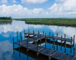
Meaher State Park’s 1,327-acres are situated in the wetlands of north Mobile Bay and is a multi-use scenic park with picnic areas, 61 RV camping sites, 10 improved tent sites all with full hook-ups and a shower house with laundry facilities for overnight visitors. A boat ramp and fishing pier will appeal to every fisherman. A self-guided walk on two nature trails includes a boardwalk with an up close view of the Mobile-Tensaw Delta.
Stop at the gate house to pay a nominal entrance fee and then drive to the shell road, which runs a quarter mile to the aforementioned boardwalk. Park here (there is a chain across the shell road at this point) and walk on toward the boardwalk that extends out into Mobile Bay. In winter, watch for Swamp and White-throated Sparrows as you approach the boardwalk. Herons, egrets, and gulls can be seen from the boardwalk, and rarely Least Bittern (summer) and Clapper Rail. In winter, American White Pelicans find this a favorite spot as do large rafts of waterfowl. In summer, this is a great place for terns, including Gull-billed Tern. In addition, Least Terns often gather on the railings of the boardwalk offering excellent views. On the south side of the island, looking west into the bay, there are often White Ibis. Yellow-crowned Night-Heron can be frequently seen near the entrance eating crabs.
GPS: N30.66917 W-87.93565
Meaher State Park
5200 Battleship Pkwy. E.
Spanish Fort, AL 36577
Phone: 251-626-5529
From the D’Olive Bay overlook, continue north on US 98 across I-10. You can either turn left (northwest) on US 98 and go to the next site, Meaher State Park (skip to next paragraph for directions to Meaher State Park). Or, you can continue straight 0.1 miles and take the next left onto Larry Dee Cawyer Drive and stop at the Scenic Overlook, which is atop the hill and surrounded by a rock wall. Area information and restrooms are available at the overlook, which is also the location of the Eastern Shore Chamber of Commerce.
From the Scenic Overlook, return to US 98, turn right at the light (west) and proceed to the junction of US 90/98/31 (Mobile Bay Causeway). Continue west on the Mobile Bay Causeway to the entrance of Meaher State Park on the left (south) [1.9].
Amenities Available:
Nearby Sites
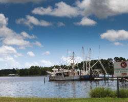
5 Rivers Delta Resource Center
5 Rivers sits on the banks of one of the canals that traverse the Mobile-Tensaw delta. The decks of the Delta Hall and the perimeter trail around the facility provide excellent vantage points to observe birds of the surrounding marsh and waterways. I …
Boggy Point
Boggy Point Boat Launch, an Alabama Department of Conservation and Natural Resources facility, offers a small beach with an excellent view of Robinson Island, a roosting site for herons and egrets, to the east. Robinson Island offers important habita …
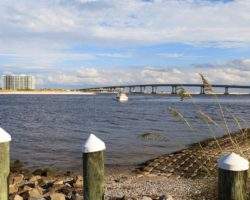
Bon Secour Bay
Bon Secour Bay is found on the eastern edge of Mobile Bay and provides a protected area for wintering waterfowl and seabirds. Scan the bay and the small canal for gulls and tern. Black-crowned Night-herons may be found roosting in the oaks scattered …
Bon Secour National Wildlife Refuge – Jeff Friend Trail
The Jeff Friend Trail is a one-mile loop to Little Lagoon. Habitats include maritime forest, freshwater marsh and open water along the north shore of Little Lagoon. A variety of species are possible-waterbirds, raptors, songbirds and other passerines …

Bon Secour NWR – Mobile Street
Mobile Street is a paved road leading to the beach, with a parking area for the one-mile (each way) Gator Lake Trail, which connects Mobile Street with the Pine Beach Trail. This narrow trail can be good for winter birding where you may see Blue-gray …
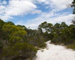
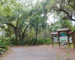
Bon Secour NWR – Pine Beach Trail
At the Pine Beach trailhead stands an interpretive kiosk with trail maps and bird lists. This is a two-mile trail (each way) southeastward to the beach by way of Little Lagoon and Gator Lake. The hike is an enjoyable walk through a variety of habitat …